

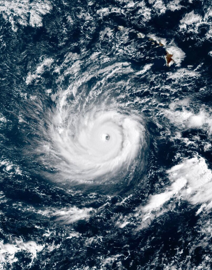
Hurricane Lowell is making its closest pass to Hawaii on Labor Day, and while the Category 3 storm isn’t expected to make landfall, its outer bands are close enough to bring hurricane-force gusts, flooding rain, and dangerous surf to the western islands.
As of Monday afternoon, Lowell’s eye was tracking roughly 100 to 200 miles west of Kauai with maximum sustained winds near 120 mph. The National Hurricane Center’s forecast has the storm’s center passing through the Papahanaumokuakea Marine National Monument, just west of the main Hawaiian Islands, overnight.
Who’s under warning
A hurricane watch and tropical storm warning are in effect for Kauai and Niihau, with forecasters calling for 6 to 10 inches of rain and isolated totals up to 14 inches on Kauai. Wind gusts up to 74 mph are possible there, while Oahu is looking at gusts closer to 40 mph. A flood watch covers the entire state through Tuesday afternoon, and surf could build to 14 feet along west-facing shores.

Hawaii’s Emergency Management Agency has been pushing residents on the western islands to prep as they would for a direct hit, since a storm that stays just offshore can still knock out power and flood low-lying roads if its rain bands drift closer than forecast.
A rough stretch for the islands
Lowell is the latest in a string of storms that have kept Hawaii on alert through the back half of the season, following earlier systems that already caused flooding and long power outages on the Big Island this summer. The upside for Hawaii this time is that Lowell is forecast to stay a safe enough distance offshore to avoid the kind of direct hit that turns a bad storm into a deadly one, but with a Category 3 system involved, that margin is not one anyone wants to test.
Related from BeezLoop: Hurricane Lowell Weakens and Pulls Away From Hawaii After Cutting Power Across Kauai, Tropical Storm Moke Brings Heavy Rain to Hawaii's Big Island Without Making Landfall and Tropical Depression Edouard Soaks Texas With Flooding Rain After Louisiana Landfall.
Sources: Fox Weather · Newsweek · Hawai’i Emergency Management Agency