

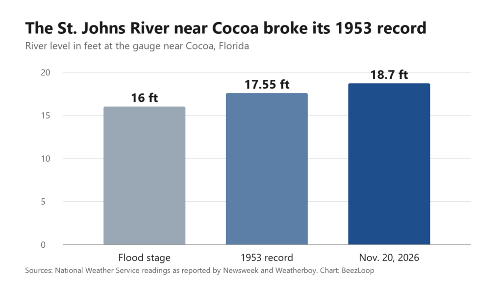
The St. Johns River near Cocoa hit 18.7 feet Friday evening, more than a foot above its 1953 record, and it isn’t going down fast. Forecasters expect it to stay near that level through the weekend and into next week, Newsweek reported, while the water moves north toward Sanford, Lake Monroe and DeLand.
In West Cocoa, more than a dozen families on Stratford Drive near Range Road still can’t get home, and some were taken out by airboat Friday because the water was too deep to wade through, WFTV reported. “It was starting to flood, and that’s why I left,” resident Leslie Cole told the station.
Why is the St. Johns River still rising after the rain stopped?
Because the St. Johns is one of the slowest rivers in the country. It flows north and drops less than 30 feet over its roughly 310-mile length, and drains a huge, flat basin of marshes and lakes. This week’s storms dumped up to 10 inches on parts of Brevard County, and some coastal spots got more. All that water is now draining into the river at once, and it can only leave so fast.

“This is just an incredible amount of water that will cause the river to continue to rise for the next several days,” Will Ulrich, a warning coordination meteorologist with the National Weather Service in Melbourne, told the Associated Press, as quoted by Newsweek. Jason Evans of Stetson University called the storm a “triple whammy” and said levels will likely take “weeks” to recede, Central Florida Public Media reported.
Which Central Florida areas are flooding next?
The flood is moving downstream. Here’s what forecasters and local reports have flagged:
- Brevard: Lake Poinsett, where water reaches homes at 17.2 feet; the Silver Pines area of Rockledge; Shakespeare Park in Cocoa; and Providence Road west of Cocoa, which has been impassable.
- Seminole: Geneva near State Road 46 was about 11.7 feet Friday night, heading for a crest near 13 feet late this weekend. Sanford is expected to reach major flood stage by the middle of next week.
- Volusia: DeLand is expected to reach about 6 feet early next week, above its 5.3-foot major flood mark, and Astor’s River Road area could stay flooded for weeks or months, according to the Weather Service via Newsweek.
- Lake County: Officials have warned conditions will worsen for communities north of Brevard, including Lake.
Where can flooded residents get help?
Brevard County opened an emergency shelter at the Walter Butler Community Center in Cocoa, and the Red Cross has opened three shelters in the county. Volusia County has sandbag sites open. Brevard has asked residents to cut back on water use because the flooding is straining wastewater systems. Check NWS Melbourne for river forecasts, and never drive through moving water. As officials keep saying: turn around, don’t drown.
This is the second major Florida flood in a week. Days earlier, South Florida took up to 15 inches of rain.
The BeezLoop Take
Flash floods get the headlines, but a river flood like this one is slower and in some ways worse. Families on the St. Johns can’t pump out and move back in; they’re waiting on a river that drains about as fast as a bathtub with a pinhole. The record that stood since 1953 is gone, and the people along this river need help that lasts as long as the water does.
Most homeowners’ policies don’t cover flood damage, and flood insurance is only required in high-risk zones. How many of the families waiting to get home actually have it?
Sources: WFTV · Central Florida Public Media · Newsweek · Weatherboy · NWS Melbourne · FOX Weather (video)